

Offered Field Trips
These field trips are being offered for IGC 2028.
If you are interested in submitting a field trip proposal, you can find more information on the Field Excursions Submissions page.
Jump to a Field Trip
FT05 - Carbox Aspiring Geopark
3 Days • Newfoundland & Labrador
Cabox Aspiring Geopark explores one of the world’s classic ophiolite complexes, where participants examine spectacular evidence of Paleozoic plate tectonics, ocean-floor formation, arc volcanism, and continental collision.
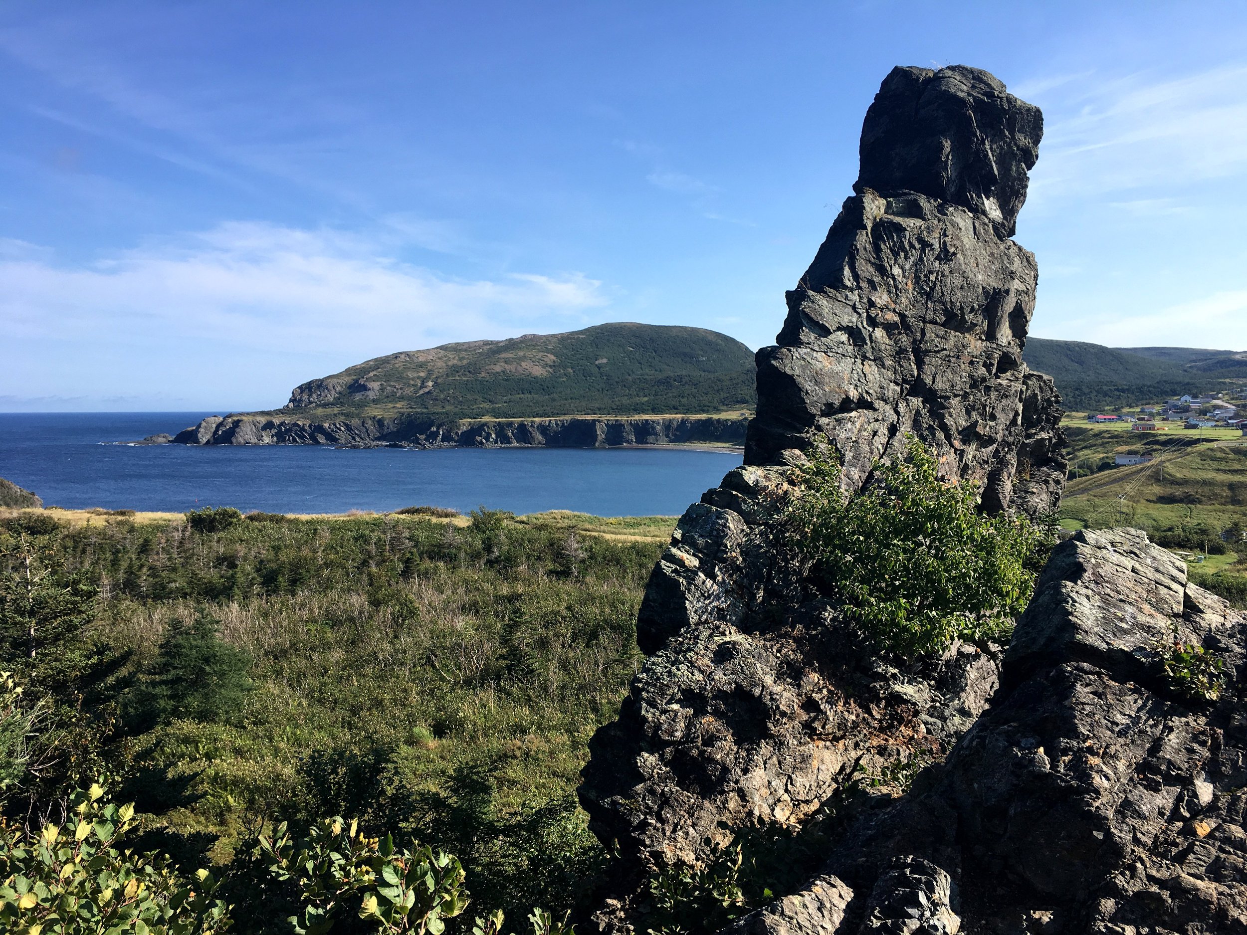
Trout River Stranded Gabbro Stack
Image credit: Paul Wylezol
Highlights
Bay of Islands Ophiolite
Pillow lavas
Interference folds
Coastal scenery
Mélanges
Arc volcanism
FT08 - Moose Mountain 100 Years
Full itinerary and trip information coming soon.
FT28 - Geology of the Foreland and Omineca Belts
4–5 Days • Alberta & British Columbia
Explore the tectonic evolution of the Foreland and Omineca belts across southwestern Alberta and southeastern British Columbia. Participants examine fold-and-thrust structures, metamorphic rocks, and magmatic processes that record the development of the Canadian Cordillera.
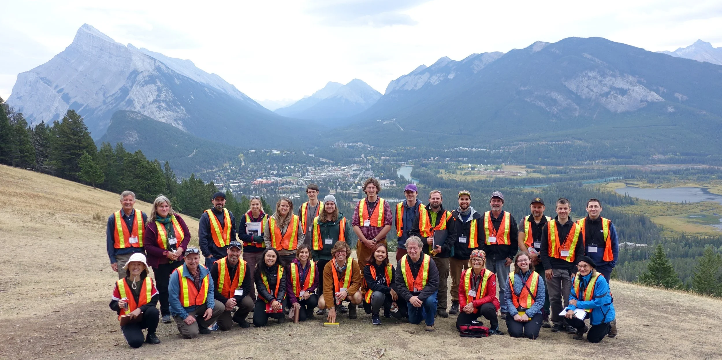
Field Geology in the Canadian Cordillera
Image credit: Photo courtesy of the field trip leaders
Highlights
Foreland fold and thrust belt
Omineca Belt
Metamorphic core complexes
Rocky Mountain Trench
Structural geology
Canadian Cordillera
FT01 - Glaciers, Tectonics, and the Klondike Gold Rush Trail
(Juneau, Alaska, USA to Whitehorse, YT, Canada)
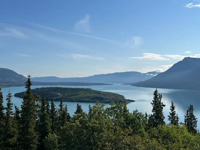
Bove Island, S Klondike highway, S of Carcross.
Image credit: Jeff Freymueller
This excursion will explore some of the spectacular geological features along the corridor from Juneau, Alaska to Whitehorse, Yukon Territory. Starting in Juneau, we will travel up Lynn Canal to Skagway, then take the historic White Pass Railroad up into Canada, following the path of the Klondike Gold Rush. In Yukon Territory, we will explore glacial, tectonic and other features, including the southern section of the Denali fault, the geological and historic records of rapidly-changing glaciers. For example, the advance and retreat of glaciers has changed the lake level of Kluane Lake dramatically over recent centuries. Mining and economic geology are closely tied to the history of the region, on both sides of the border.
Duration: 4-5 days
Field Trip Leader
Dr. Jeffrey Freymueller, Endowed Chair for Geology of the Solid Earth, Department Chair
Dept. of Earth and Environmental Sciences
Michigan State University

Sentinel Island Lighthouse, N of Juneau.
Image credit: Jeff Freymueller
FT02 - Burgess Shale Walcott Quarry

Walcott Quarry with Wapta Mountain behind
Image credit: Paul Johnston and Christopher Collom
This day-long guided hike takes you to the high country of Yoho National Park to view the Walcott Quarry in the 508 million year old Burgess Shale, a UNESCO World Heritage site. Famous for excellently preserved invertebrate fossils, the Burgess Shale offers a rare window on the early evolution of animal phyla during the "Cambrian Explosion.” The hike provides an overview of middle Cambrian geology and palaeontology in the area and evidence for coeval hydrothermal mineralization. Glaciers visible along the way show evidence of retreat during the modern warm period.
The Walcott Quarry site has limited access, and only two groups of 12 participants are allowed by Parks Canada per day. Participants should be fit as the hike is 22 kilometres round-trip, with 825 metres of elevation gain.Good quality boots or trail shoes and a hat are a must. All participants should bring 2 litres of water and sufficient energy snacks / food, with clothing suitable for rain or sun. Participants will depart Calgary (7:00 a.m.) by bus, arriving at the trailhead by 10:00 a.m. The hike returns to the trailhead about 6:00 p.m., with a return to Calgary by about 9:00 p.m.
Duration: 1 day
Field Trip Leaders
Dr. Paul Johnston, Department of Earth & Environmental Sciences, Mount Royal University
Dr. Chris Collum, Department of Earth & Environmental Sciences, Mount Royal University

Split shale slab revealing a fossil sponge
Image credit: Paul Johnston and Christopher Collom
FT03 - Dinosaur paleobiology and depositional environments of Dinosaur Provincial Park, UNESCO World Heritage Site
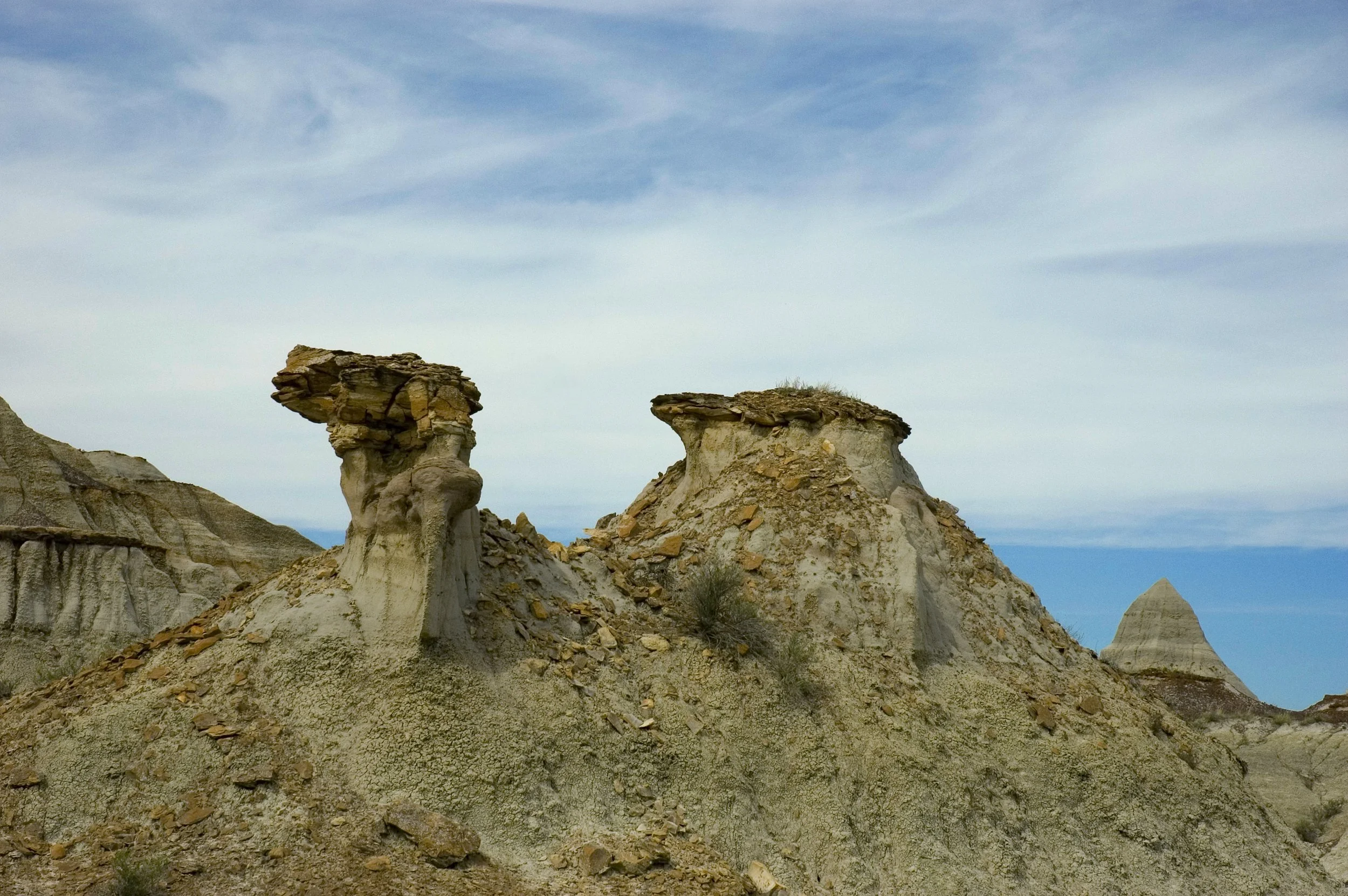
Dinosaur Provincial Park (DPP) is the largest area of badlands topography in Canada, was the first UNESCO World Heritage Site designated based on fossil material, and is globally recognized for its abundance of Late Cretaceous vertebrate fossils, especially dinosaurs. Due to the abundance and high-quality preservation of vertebrate fossils, DPP has historically been, and remains today, an epicenter of paleontological research. Participants will enjoy a day of hiking across outcrop of upper Belly River Group transgressive sequence (fluvial to estuarine) including the Oldman, Dinosaur Park and Bearpaw formations. The hike will take participants to historic and current paleontological sites, with a specific focus on different vertebrate taphonomic modes, including articulated skeletons, monodominant ceratopsian (horned dinosaur) bonebeds, multitaxic microvertebrate bonebeds, isolated bones, and possible dinosaur trackways, as well as paleobotanical sites. The history of collecting and research, vertebrate diversity and paleoecology, and changing ideas of dinosaur paleobiology in DPP will be covered.
Dinosaur Provincial Park is a two-hour drive from Calgary. Participants can expect to spend most of the day hiking over uneven terrain with no shade; appropriate footwear and sun protection are recommended. The field trip will be restricted to the hike, with no collecting involved.
Dinosaur Provincial Park
Image credits: Royal Tyrell Museum
Dinosaur Provincial Park
Image credit: Royal Tyrell Museum
Duration: 1 day
Field Trip Leaders
Dr. Craig Scott, Director, Preservation and Research, Royal Tyrrell Museum of Palaeontology
Dr. Caleb Brown, Curator of Dinosaur Systematics and Evolution, Royal Tyrrell Museum of Palaeontology
FT04 - Sudbury Impact Structure and Evolution of the Impact Melt and Associated Ni-Cu-PGE Mineralization
The 1.85 Ga Sudbury Impact Structure is one of the world’s oldest, largest, best-preserved, and best-exposed extraterestrial impact structures. It also contains some of the world’s largest and most valuable Ni-Cu-PGE deposits, some of which are still in operation, under development, or being defined. The trip will provide an overview of the geology of the Sudbury Structure with an emphasis on the evolution of the impact melt sheet and its relationship to the associated Ni-Cu-(PGE) sulfide ores. We will examine a wide range of spectacular mechanically ± hydraulically-stripped outcrops and road cuts to illustrate: 1) the effects of shock metamorphism on the surrounding target rocks (e.g., shatter cones and pseudotachylites), 2) the crystallization products of the impact melt sheet, 3) the various types of ore-hosting magmatic breccias, and 4) fall-back and suevitic material from the impact. Sudbury is home to the Harquail School of Earth Sciences and Mineral Exploration Research Centre at Laurentian University, which will host evening lectures. The field trip will start and end in Sudbury and local transportation will be provided.
Shattercones Fourth Avenue
Image credit: Paul Golightly
Dinosaur Provincial Park
Image credit: Royal Tyrell Museum
Large nested shattercones, Hwy 17 Whitefish
Image credit: CML
Duration: 5 days
Field Trip Leaders
Michael Lesher, Laurentian University
Dustin Peters, Laurentian University
Sandra Baurier Aymat, Laurentian University
Sublayer, Whistle Mine
Image credit: CML
Sudbury Breccia, Creighton
Image credit: CML
Footwall Breccia, Hwy 144 Bypass
Image credit: CML